Town & Country Implements a Successful Stormwater Program
- Local Governments
Market
- Construction
- Engineering
- Planning
- Water
- Water + Wastewater Planning
- Water Resources
Services
- Town & Country, Missouri
Locations
The City of Town & Country, Missouri adopted a policy and an associated ongoing program to alleviate drainage problems that have had a detrimental effect on both public infrastructure and private properties. The program is funded from portions of the ½ cent sales tax collected for Parks and Storm Water Improvements. Since the inception of the stormwater program, the Director of Public Works has identified 43 projects for consideration to be included in the program. For those 43 projects, HR Green was selected as the primary engineering consultant and has assisted the Director in developing a preliminary Scope of Work for each project, completing a Location Benefit Indication (LBI) form for each affected property, and an Opinion of Probable Construction Cost (OPC) for each project, from which a cost to benefit ratio was derived. OPCs range from $30,000 to $425,000, totaling approximately $6.4-million and the number of properties affected range from one to more than twenty, totaling over 200 properties.
The scopes of work range from alleviating surface erosion to the construction of piped conveyance to the stabilization of urbanized open drainage channels to detention and water quality related projects. The project scopes, LBIs and OPCs were presented to the City’s Public Works and Storm Water Commission in sessions open to the public. All stakeholders, particularly the affected property owners, were encouraged to attend and participate in the open session. Projects adopted by the Commission were then ranked with the highest priority given to those with the lowest cost to benefit ratio. Projects were inserted into the ranking system based solely on the calculated ratio regardless of the order of identification.
The Commission presented the program to the City’s Board of Alderman in the form of a five year implementation plan as a part of the City’s annual budgeting process. The target year for construction of the highest to lowest ranked projects was derived by comparing project cumulative OPC’s to the schedule of anticipated funding that should be available from the Parks and Storm Water Improvement Tax. It is intended for the program to be re-evaluated by the Commission on a regular basis and re-presented to the Board as new projects are identified and included in the program.
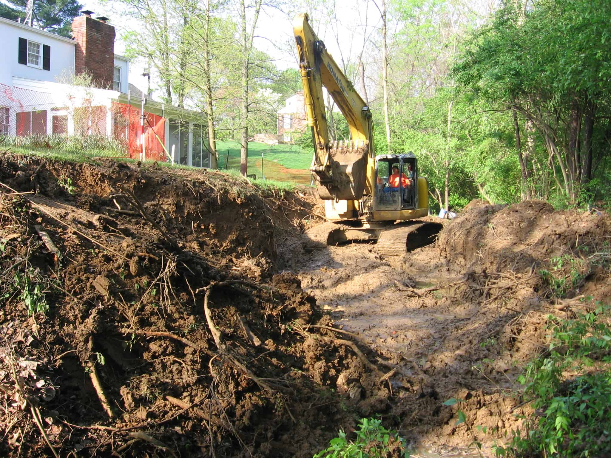
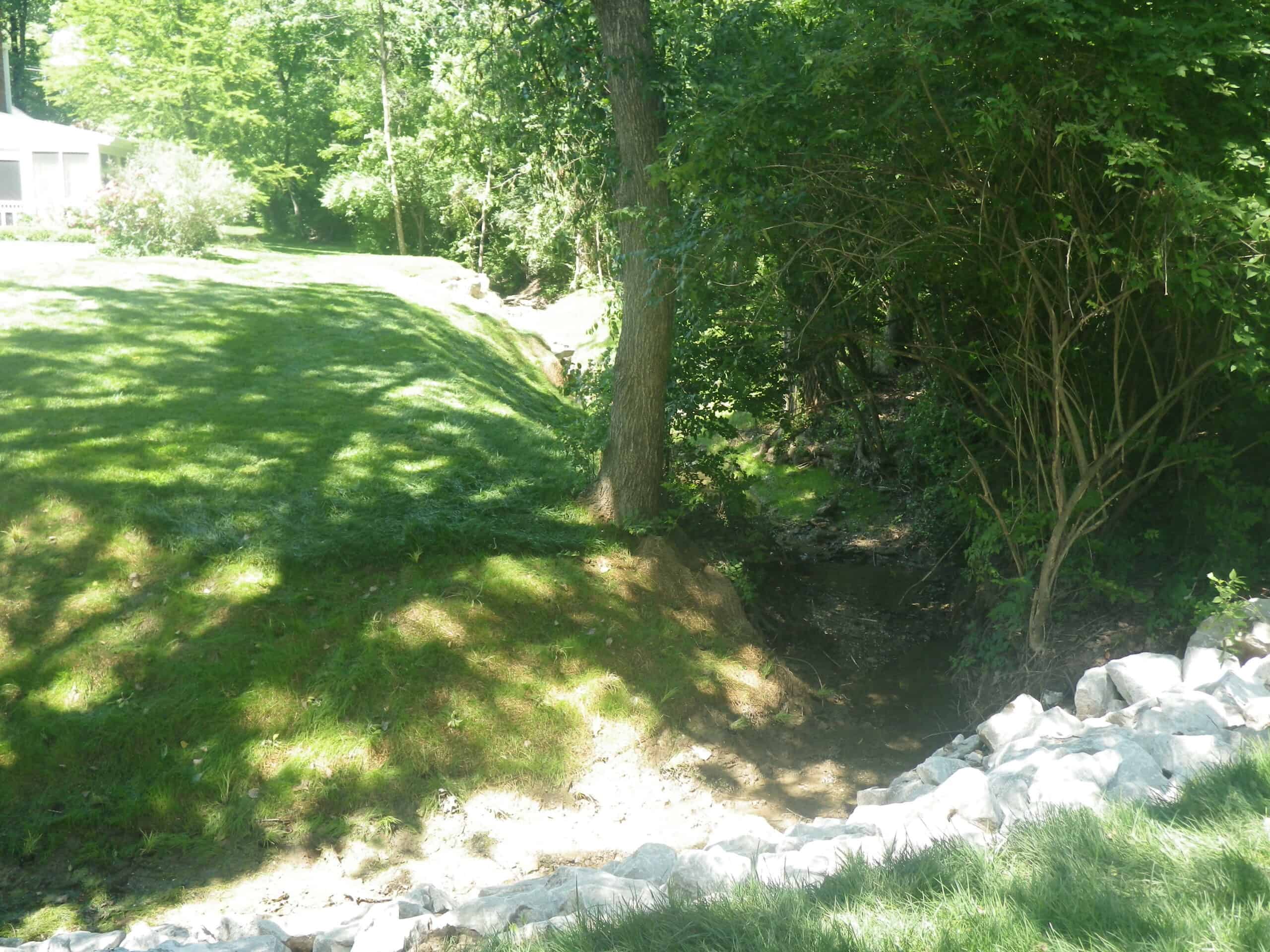
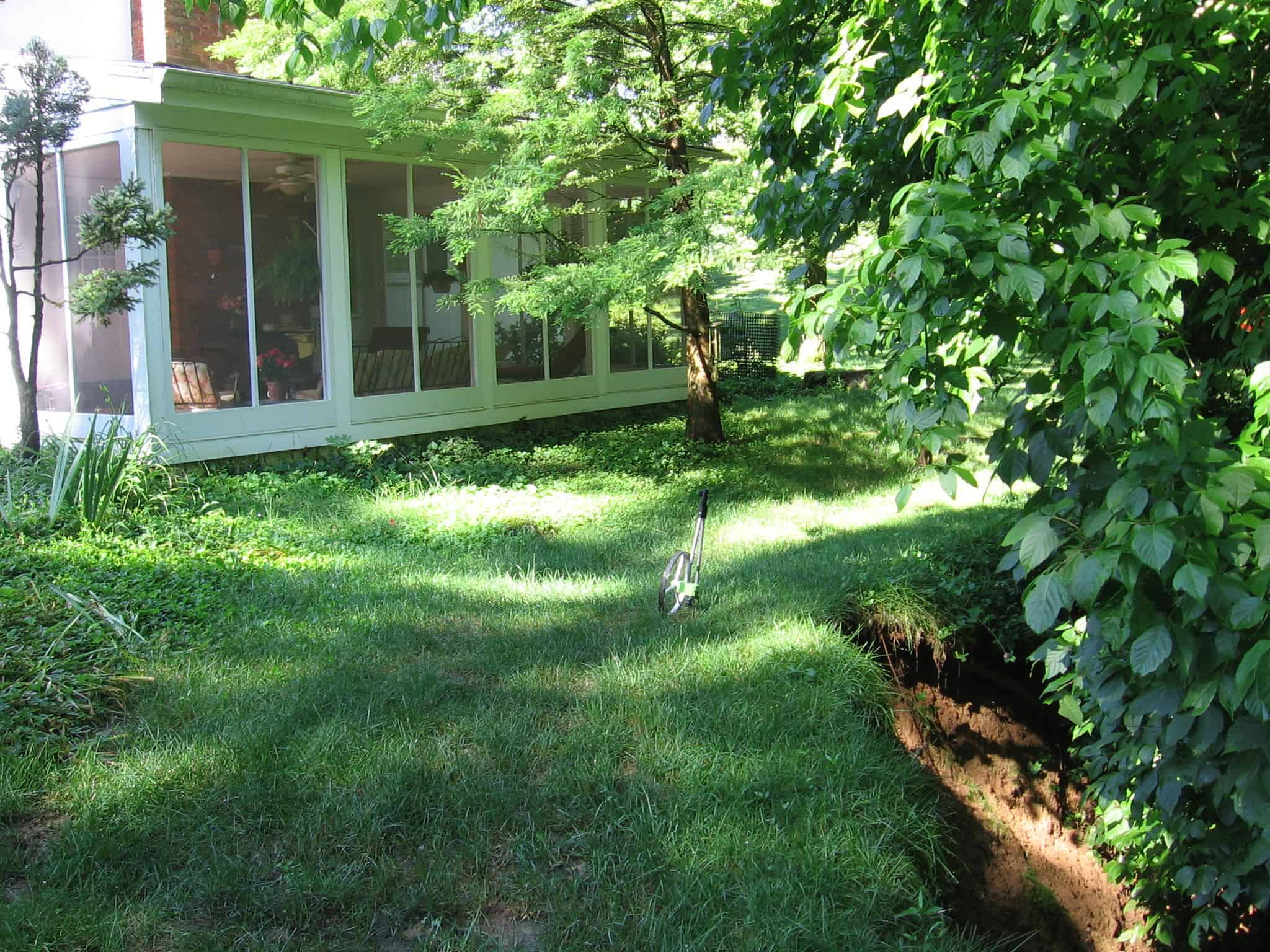
Subsequent to program implementation by the City, HR Green designed the improvements and prepared plans, specifications and estimates for 34 projects to date. These projects include bank stabilization and storm sewer design. In addition, HR Green assisted the Director with the procurement of construction bids and with the awarding of construction contracts. One of these projects included the design of channel improvements for an unstudied tributary of the Grand Glaize West Creek abutting a private property. In the summer of 2010, a field visit was conducted to understand the extents of the stream bank issues presented by the private property owner. As seen in the pre-construction photo, active bank erosion was occurring, specifically in the backyard and less severely, but present on the side yard of the property as well.
The once heavily vegetated banks within these two sections had eroded away resulting in near vertical slump failure of the clay banks. To address concerns for potential property loss, a geotechnical study and a detailed topographic survey were conducted to facilitate improvement efforts. The findings of the subsurface exploration concluded that the banks are mainly composed of alluvial soils consisting of lean clays and silts with an associated angle of friction of approximately 2H:1V for drained conditions. Boring logs show refusal depths that match closely with the stream bed elevation thus indicating the stream bed is lying on bedrock. Because of the upstream and downstream grade control structures and the presence of bedrock, stream incision in the vertical direction is most likely reached its equilibrium state. In addition to gathering detailed channel and bank topography information, the survey identified the location and size of existing vegetation. In review of the stream topographic survey and field observation notes, sections of the bank that are relatively stable are also densely vegetated.
To stabilize the field observed bank failure area, correlated with the existing model results, the improvements included 24” riprap revetment, fabric encapsulated soil (FES) lifts, turf reinforcement mats (TRM), and slight channel realignment. Bank failure nearest the residential structure was the most critical section for design purposes; a 15-year flow depth and associated channel velocity and shear values were used to select the riprap design height and average size for this location. Applying a factor of safety and a 1’ freeboard height above the reported 15-yr depth, a riprap design height of 4 to 4.5 feet was determined. Using the U.S. Department of Transportation HEC-11 design standards for sizing riprap, an average riprap size (d50) of 24” was calculated. To prevent failure from occurring at the toe, the riprap was buried at least one to two times the d50 from the steam bed elevation or to bedrock. The streambank armoring and bio-stabilization approach was to use riprap at 0.5:1 slope transitioning to FES lifts at 2:1 slope to match existing. The FES lifts were planted with native seed mix and plant species (live stakes). Turf reinforcement mat (TRM) was installed on cut areas of the left descending bank and also planted with native seed mix and plant species (live stakes). The design approach minimized changes to the alignment while providing stability to the right descending bank and gaining yard area back for the property owner. In the subsurface investigation and geotechnical report, slope analysis was done for a 4’ vertical rock wall and 2:1 side slope and found the system stable with a factor of safety of approximately 2.5.
